Category:Barnwell, Northamptonshire
Jump to navigation
Jump to search
English: Barnwell (formerly Barnwell All Saints and Barnwell St Andrew) is a village in the district of East Northamptonshire in England, south of the town of Oundle.
village and civil parish in Northamptonshire, UK  | |||||
| Upload media | |||||
| Instance of | |||||
|---|---|---|---|---|---|
| Location | North Northamptonshire, Northamptonshire, East Midlands, England | ||||
| Population |
| ||||
| Said to be the same as | Barnwell (Wikimedia duplicated page, civil parish) | ||||
 | |||||
Subcategories
This category has the following 7 subcategories, out of 7 total.
A
- All Saints Chancel, Barnwell (2 F)
- St Andrew's Church, Barnwell (9 F)
B
- Barnwell Castle (4 F)
- Barnwell Manor (2 F)
- Barnwell railway station (4 F)
M
- Montagu Arms, Barnwell (4 F)
O
- Oundle Mill (11 F)
Media in category "Barnwell, Northamptonshire"
The following 200 files are in this category, out of 223 total.
(previous page) (next page)-
 A wet afternoon in Barnwell - geograph.org.uk - 3063462.jpg 1,024 × 768; 1.27 MB
-
 All Saints' church, Barnwell - geograph.org.uk - 6549403.jpg 1,024 × 762; 210 KB
-
 All Saints' church, Barnwell - geograph.org.uk - 6549406.jpg 1,024 × 768; 207 KB
-
 Almshouses - geograph.org.uk - 108376.jpg 640 × 480; 60 KB
-
 Apples on the roadside - geograph.org.uk - 3687332.jpg 4,320 × 3,240; 5.52 MB
-
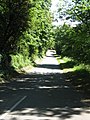 Back Lane To Barnwell - geograph.org.uk - 1334544.jpg 480 × 640; 241 KB
-
 Barley field and distant water tower - geograph.org.uk - 6550349.jpg 1,024 × 768; 177 KB
-
 Barley field and North Lodge Farm (geograph 6549778).jpg 1,024 × 768; 174 KB
-
 Barn at Castle Farm, Barnwell - geograph.org.uk - 6550330.jpg 1,024 × 768; 160 KB
-
 Barn at Manor Farm, Oundle - geograph.org.uk - 6533554.jpg 1,876 × 1,210; 1.33 MB
-
 Barnwell - geograph.org.uk - 3077345.jpg 4,320 × 3,240; 5.84 MB
-
 Barnwell - Lane To The Castle - geograph.org.uk - 1334563.jpg 640 × 480; 233 KB
-
 Barnwell - Lane To The Castle - geograph.org.uk - 1334570.jpg 640 × 480; 220 KB
-
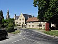 Barnwell - The Village Centre - geograph.org.uk - 1334551.jpg 640 × 480; 204 KB
-
 Barnwell - Typical Thatched Cottages - geograph.org.uk - 1334555.jpg 640 × 480; 212 KB
-
 Barnwell Brook and The Mantagu Arms - geograph.org.uk - 4770539.jpg 4,320 × 3,240; 5.86 MB
-

-

-

-

-

-

-
 Barnwell Country Park - Mill Lake, near Oundle - geograph.org.uk - 2924571.jpg 1,024 × 681; 228 KB
-

-
 Barnwell Ford - geograph.org.uk - 3019808.jpg 3,264 × 2,448; 4.09 MB
-
 Barnwell Lock - geograph.org.uk - 3272153.jpg 2,560 × 1,920; 1.04 MB
-
 Barnwell Lock - geograph.org.uk - 4169276.jpg 1,024 × 683; 269 KB
-
 Barnwell Manor - geograph.org.uk - 6550325.jpg 1,024 × 768; 219 KB
-
 Barnwell Mill Farm - geograph.org.uk - 3687336.jpg 4,320 × 3,240; 5.56 MB
-
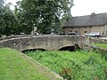
 Barnwell road bridge - geograph.org.uk - 1340176.jpg 640 × 480; 135 KB
-
 Barnwell Road near Oundle - geograph.org.uk - 2944666.jpg 1,024 × 650; 219 KB
-
 Barnwell Road near Oundle - geograph.org.uk - 2944684.jpg 1,024 × 666; 201 KB
-
 Barnwell water tower - geograph.org.uk - 4170437.jpg 640 × 480; 51 KB
-
 Barnwell Water Tower - geograph.org.uk - 827250.jpg 480 × 640; 74 KB
-
 Barnwell, July rain - geograph.org.uk - 3063438.jpg 1,024 × 768; 1,018 KB
-
 Beside Barnwell Wold - geograph.org.uk - 5674548.jpg 640 × 480; 67 KB
-
 Between Clopton and Thurning - geograph.org.uk - 4769790.jpg 4,320 × 3,240; 6 MB
-
 Bigley's, Barnwell - geograph.org.uk - 6550314.jpg 1,024 × 768; 219 KB
-
 Bird boxes in Barnwell Country Park - geograph.org.uk - 3687648.jpg 4,320 × 3,240; 5.77 MB
-
 Bonfire Night Approaches - geograph.org.uk - 1021695.jpg 640 × 480; 46 KB
-
 Bridge and ford in Barnwell - geograph.org.uk - 4770692.jpg 4,320 × 3,240; 5.99 MB
-
 Bridge over Barnwell Brook (geograph 6549873).jpg 1,024 × 768; 304 KB
-
 Bridge over Barnwell Brook near the castle - geograph.org.uk - 4770710.jpg 4,320 × 3,240; 5.65 MB
-
 Bridleway alongside Barnwell Wold - geograph.org.uk - 4769784.jpg 4,320 × 3,240; 5.7 MB
-
 Bridleway bridge near Barnwell Wold - geograph.org.uk - 4769795.jpg 4,320 × 3,240; 5.96 MB
-
 Bridleway in Barnwell - geograph.org.uk - 874851.jpg 480 × 640; 141 KB
-
 Bridleway near Bright Pitts Farm - geograph.org.uk - 6543720.jpg 1,024 × 768; 185 KB
-
 Bridleway near North Lodge Farm - geograph.org.uk - 6543723.jpg 1,024 × 768; 200 KB
-
 Bridleway near North Lodge Farm - geograph.org.uk - 6549757.jpg 1,024 × 768; 173 KB
-
 Bridleway near South Lodge Farm - geograph.org.uk - 6543717.jpg 1,024 × 768; 197 KB
-
 Bridleway nearing the end of the field - geograph.org.uk - 6549789.jpg 1,024 × 768; 194 KB
-
 Bridleway off the road to Clopton - geograph.org.uk - 5674550.jpg 480 × 640; 47 KB
-
 Bridleway to Armston - geograph.org.uk - 6543732.jpg 1,024 × 768; 212 KB
-
 Bridleway to Armston - geograph.org.uk - 6549648.jpg 1,024 × 768; 150 KB
-
 Bridleway to Armston - geograph.org.uk - 6549735.jpg 1,024 × 768; 234 KB
-
 Bridleway to Armston - geograph.org.uk - 6549864.jpg 1,024 × 768; 252 KB
-
 Bridleway to Armston and Luddington in the Brook - geograph.org.uk - 6549765.jpg 1,024 × 768; 155 KB
-
 Bridleway to Clopton - geograph.org.uk - 6549437.jpg 1,024 × 768; 235 KB
-
 Bridleway to Clopton - geograph.org.uk - 6549468.jpg 1,024 × 768; 195 KB
-
 Bridleway to Clopton, Barnwell - geograph.org.uk - 6549417.jpg 1,024 × 768; 152 KB
-
 Bridleway to Luddington in the Brook - geograph.org.uk - 6549862.jpg 1,024 × 768; 175 KB
-
 Bridlweway to Barnwell - geograph.org.uk - 6549471.jpg 1,024 × 768; 207 KB
-
 Broadway Corner Towards Barnwell - geograph.org.uk - 827309.jpg 640 × 480; 95 KB
-
 Broadway Corner Towards Thurning - geograph.org.uk - 827320.jpg 640 × 480; 115 KB
-
 Cambridge Rim Roll - geograph.org.uk - 111634.jpg 640 × 471; 88 KB
-
 Capped Post - geograph.org.uk - 860129.jpg 480 × 640; 72 KB
-
 Cast Thy Bread Upon The Waters - geograph.org.uk - 1021671.jpg 480 × 640; 71 KB
-

-
 Concrete Wicket - geograph.org.uk - 1021656.jpg 640 × 480; 100 KB
-
 Coronation Bus Shelter Barnwell - geograph.org.uk - 1131331.jpg 640 × 480; 85 KB
-
 Coronation Plaque Barnwell - geograph.org.uk - 1131337.jpg 640 × 480; 69 KB
-
 Cottage near Barnwell Castle - geograph.org.uk - 874914.jpg 640 × 480; 95 KB
-
 Cottages in Barnwell - geograph.org.uk - 6550054.jpg 1,024 × 768; 233 KB
-
 Countryside bridleway - geograph.org.uk - 6692313.jpg 768 × 1,024; 162 KB
-
 Countryside bridleway - geograph.org.uk - 6692315.jpg 768 × 1,024; 166 KB
-
 Countryside bridleway - geograph.org.uk - 6692319.jpg 768 × 1,024; 181 KB
-
 Crane at Oundle marina - geograph.org.uk - 1340162.jpg 480 × 640; 94 KB
-
 Dags Barnwell - geograph.org.uk - 1131325.jpg 640 × 480; 98 KB
-
 Dodson Bros thatching in Barwell, Northamptonshire - geograph.org.uk - 4771371.jpg 4,320 × 3,240; 5.67 MB
-
 Drive to Bright Pitts Farm near Barnwell - geograph.org.uk - 4768490.jpg 4,320 × 3,240; 5.96 MB
-
 Elm trees by the bridleway near South Lodge farm - geograph.org.uk - 1719625.jpg 2,736 × 3,648; 2.26 MB
-
 End of the bridleway - geograph.org.uk - 5674547.jpg 480 × 640; 66 KB
-
 Entrance to Barnwell Country Park, near Oundle - geograph.org.uk - 2944703.jpg 1,024 × 650; 271 KB
-
 Entrance To Fairline Boats - geograph.org.uk - 873660.jpg 640 × 480; 107 KB
-
 Entrance to Oundle Marina - geograph.org.uk - 1340015.jpg 640 × 480; 109 KB
-
 Entrance to Parson Latham's Almshouses - geograph.org.uk - 6549892.jpg 1,024 × 773; 170 KB
-
 Entrance to Supreme Concrete - geograph.org.uk - 874582.jpg 480 × 640; 111 KB
-
 Entrance to the Montagu Arms, Barnwell - geograph.org.uk - 6550289.jpg 1,024 × 768; 161 KB
-
 Estate Houses - geograph.org.uk - 874979.jpg 640 × 480; 103 KB
-
 Farm track near Barnwell - geograph.org.uk - 6549433.jpg 1,024 × 768; 225 KB
-
 Farm track off Thurning Road - geograph.org.uk - 6550342.jpg 1,024 × 768; 164 KB
-
 Farmhouse, Barnwell - geograph.org.uk - 825478.jpg 640 × 480; 82 KB
-
 Farmland - geograph.org.uk - 108257.jpg 640 × 480; 82 KB
-
 Farmland in front of North Lodge Farm - geograph.org.uk - 4768319.jpg 4,320 × 3,240; 5.49 MB
-
 Farmland west of Thurning, Northamptonshire - geograph.org.uk - 4768295.jpg 4,320 × 3,240; 5.46 MB
-
 Fast Road From Oundle - geograph.org.uk - 1334679.jpg 640 × 480; 190 KB
-
 Field bridleway - geograph.org.uk - 5682390.jpg 640 × 480; 87 KB
-
 Field bridleway - geograph.org.uk - 5682405.jpg 480 × 640; 88 KB
-
 Field bridleway - geograph.org.uk - 5682407.jpg 640 × 480; 96 KB
-
 Field bridleway - geograph.org.uk - 5682410.jpg 640 × 480; 69 KB
-
 Field edge and remains of a tree - geograph.org.uk - 6549741.jpg 1,024 × 768; 191 KB
-
 Field edge near Barnwell - geograph.org.uk - 6549449.jpg 1,024 × 768; 190 KB
-
 Field edge near North Lodge Farm - geograph.org.uk - 6549805.jpg 1,024 × 768; 187 KB
-
 Field edge near Watkin's Parlour - geograph.org.uk - 6543730.jpg 1,024 × 768; 181 KB
-
 Field edge near Wigsthorpe - geograph.org.uk - 6549474.jpg 1,024 × 768; 207 KB
-
 Field footpath - geograph.org.uk - 5682411.jpg 480 × 640; 71 KB
-
 Field of oats and three phase power line - geograph.org.uk - 6549750.jpg 1,024 × 768; 210 KB
-
 Field of rapeseed near Barnwell Lodge Farm - geograph.org.uk - 4768504.jpg 4,144 × 2,992; 4.81 MB
-
 Flock of woolly sheep - geograph.org.uk - 3687446.jpg 4,320 × 3,240; 5.78 MB
-
 Floodbank at Barnwell - geograph.org.uk - 6543660.jpg 1,024 × 768; 207 KB
-

-

-
 Following the field edge - geograph.org.uk - 6549795.jpg 1,024 × 768; 182 KB
-

-
 Footbridge over Barnwell Brook - geograph.org.uk - 4770527.jpg 4,320 × 3,240; 5.64 MB
-
 Footbridge over the Barnwell Brook - geograph.org.uk - 6550050.jpg 1,024 × 768; 314 KB
-
 Footbridge over the Barnwell Brook - geograph.org.uk - 6550318.jpg 1,024 × 768; 307 KB
-
 Footpath - geograph.org.uk - 108258.jpg 640 × 480; 83 KB
-
 Footpath near Barnwell - geograph.org.uk - 6692311.jpg 768 × 1,024; 149 KB
-
 Footpath to a water tower - geograph.org.uk - 6543726.jpg 1,024 × 768; 143 KB
-
 Footpath to Armston - geograph.org.uk - 6543736.jpg 1,024 × 768; 184 KB
-
 Footpath to Armston - geograph.org.uk - 6550336.jpg 1,024 × 768; 184 KB
-
 Footpath To Polebrook - geograph.org.uk - 827357.jpg 640 × 480; 112 KB
-
 Footpath to Thurning - geograph.org.uk - 6543718.jpg 1,024 × 768; 150 KB
-
 Forage Maize - geograph.org.uk - 873693.jpg 640 × 480; 120 KB
-
 Ford and Foot Bridge. - geograph.org.uk - 825147.jpg 640 × 480; 107 KB
-
 Ford at Armston - geograph.org.uk - 3019800.jpg 3,264 × 2,448; 3.22 MB
-
 Friars Close Farm, Barnwell - geograph.org.uk - 6692310.jpg 768 × 1,024; 178 KB
-
 Gate letting on to Thurning Road - geograph.org.uk - 6550341.jpg 1,024 × 768; 256 KB
-
 Grass field and hollow way, Barnwell - geograph.org.uk - 6543745.jpg 1,024 × 768; 144 KB
-
 Grass fields and St. Andrew's church, Barnwell - geograph.org.uk - 6543742.jpg 1,024 × 768; 184 KB
-
 Grassland and Barnwell Manor - geograph.org.uk - 6543738.jpg 1,024 × 768; 173 KB
-
 Jones crane by Oundle Marina - geograph.org.uk - 3272141.jpg 1,920 × 2,560; 1,006 KB
-
 Lake in Barnwell Country Park - geograph.org.uk - 3687621.jpg 4,320 × 3,240; 5.62 MB
-
 Lane and dike in Barnwell, Northamptonshire - geograph.org.uk - 4770431.jpg 4,320 × 3,240; 5.53 MB
-
 Lathams Almshouses - geograph.org.uk - 108378.jpg 640 × 480; 63 KB
-
 Lower Farm - geograph.org.uk - 4143624.jpg 2,048 × 1,536; 557 KB
-
 Main Road To Barnwell - geograph.org.uk - 1334547.jpg 480 × 640; 242 KB
-
 Main Street and Barnwell Brook in Barnwell - geograph.org.uk - 4770512.jpg 4,320 × 3,240; 5.63 MB
-
 Main Street, Barnwell - geograph.org.uk - 6549407.jpg 1,024 × 768; 338 KB
-
 Main Street, Barnwell - geograph.org.uk - 6692307.jpg 768 × 1,024; 173 KB
-
 Main Street, Barnwell - geograph.org.uk - 6692308.jpg 768 × 1,024; 209 KB
-
 Manor Farm, Oundle - geograph.org.uk - 6536055.jpg 1,878 × 1,214; 1.07 MB
-
 Meet the locals - geograph.org.uk - 1704940.jpg 2,736 × 3,648; 2.16 MB
-
 Muddy track to Common Wold and Barnwell Wold - geograph.org.uk - 4769772.jpg 4,320 × 3,240; 5.6 MB
-
 Nene Way south of Oundle - geograph.org.uk - 6533555.jpg 1,874 × 1,208; 1.52 MB
-
 Nicholas Latham Almshouses - geograph.org.uk - 1021663.jpg 640 × 480; 92 KB
-
 North Lodge and the Barnwell water tower - geograph.org.uk - 1719550.jpg 3,648 × 2,736; 2.14 MB
-
 Oak tree by the footpath at North Lodge farm - geograph.org.uk - 1719583.jpg 2,736 × 3,648; 2.1 MB
-
 Oat field and trees by a brook - geograph.org.uk - 6543666.jpg 1,024 × 768; 268 KB
-

-
 Ordnance Survey Flush Bracket S8220 - geograph.org.uk - 4138635.jpg 4,000 × 3,000; 3.15 MB
-
 Oundle Cruising Club - geograph.org.uk - 1339999.jpg 640 × 480; 125 KB
-
 Parkers Patch, Barnwell (geograph 6550032).jpg 1,024 × 768; 161 KB
-
 Parson Latham's Almshouses and Chapel - geograph.org.uk - 6549880.jpg 1,024 × 768; 182 KB
-
 Pile of logs near Barnwell Wold - geograph.org.uk - 4769781.jpg 4,320 × 3,240; 6.17 MB
-
 Pond and water tower - geograph.org.uk - 6549808.jpg 1,024 × 768; 319 KB
-
 Porch Inscription on Cottage - geograph.org.uk - 874925.jpg 480 × 640; 113 KB
-
 Post Office, Barnwell - geograph.org.uk - 4170432.jpg 640 × 480; 87 KB
-
 Pumping Station - geograph.org.uk - 873646.jpg 480 × 640; 106 KB
-
 Pumping Station by the River Nene, Oundle - geograph.org.uk - 5806017.jpg 1,280 × 960; 550 KB
-
 Railway sleepers near Barnwell - geograph.org.uk - 1340192.jpg 640 × 480; 152 KB
-
 Recycling Site - geograph.org.uk - 874590.jpg 640 × 480; 90 KB
-
 Reservoir and pumping station (disused) - geograph.org.uk - 1719610.jpg 3,648 × 2,736; 2.16 MB
-
 River Nene, near Oundle - geograph.org.uk - 2936478.jpg 1,024 × 677; 217 KB
-
 Road Into Barnwell - geograph.org.uk - 827341.jpg 640 × 480; 114 KB
-
 Road to Barnwell - geograph.org.uk - 5682409.jpg 640 × 480; 79 KB
-
 Road to Clopton - geograph.org.uk - 5674549.jpg 640 × 480; 53 KB
-
 Road To Hemington - geograph.org.uk - 825510.jpg 640 × 480; 109 KB
-
 Road to Thurning - geograph.org.uk - 6692312.jpg 768 × 1,024; 129 KB
-
 Shady Lane To Barnwell - geograph.org.uk - 1334596.jpg 480 × 640; 277 KB
-
 Short Bridleway - geograph.org.uk - 874846.jpg 640 × 480; 101 KB
-
 Slightly off the countryside bridleway - geograph.org.uk - 6692317.jpg 768 × 1,024; 193 KB
-
 Sluice on the Barnwell Brook - geograph.org.uk - 6549425.jpg 1,024 × 768; 219 KB
-
 Sluice on the Barnwell Brook - geograph.org.uk - 6549430.jpg 1,024 × 768; 267 KB
-
 South Bridge, Oundle - geograph.org.uk - 3687607.jpg 4,320 × 3,240; 5.42 MB
-
 Spring sown barley field - geograph.org.uk - 6549644.jpg 1,024 × 768; 209 KB
-
 Squirrel and acorn in Barnwell Country Park - geograph.org.uk - 3687726.jpg 4,320 × 3,240; 5.51 MB
-
 Squirrel with an acorn - Barnwell Country Park - geograph.org.uk - 3687708.jpg 4,320 × 3,240; 5.57 MB
-
 St. Andrew's churchyard, Barnwell - geograph.org.uk - 6550015.jpg 1,024 × 768; 204 KB
-
 Stone bridge in Barnwell, Northamptonshire - geograph.org.uk - 4770468.jpg 4,320 × 3,240; 5.61 MB
-
 Stone walls near the church in Barnwell - geograph.org.uk - 4770442.jpg 4,320 × 3,240; 5.87 MB
-
 Supreme Concrete - geograph.org.uk - 874586.jpg 640 × 480; 59 KB
-
 Thatched cottage in Barnwell - geograph.org.uk - 6550300.jpg 1,024 × 768; 158 KB
-
 Thatched cottages, Barnwell - geograph.org.uk - 6550044.jpg 1,024 × 768; 196 KB
-
 Thatcher's straw on the bank of Barnwell Brook - geograph.org.uk - 4771363.jpg 4,320 × 3,240; 5.69 MB
-
 Thatching a cottage on Main Street, Barnwell - geograph.org.uk - 4771386.jpg 4,320 × 3,240; 5.99 MB
-
 The A605, Barnwell - geograph.org.uk - 6533556.jpg 1,892 × 1,236; 1.56 MB
-
 The Barnwell Brook - geograph.org.uk - 6549414.jpg 1,024 × 768; 271 KB
-
 The Centre Of Barnwell - geograph.org.uk - 1429513.jpg 640 × 481; 78 KB
-
 The Montagu Arms pub - geograph.org.uk - 4143625.jpg 2,048 × 1,536; 549 KB
-
 The Montagu Arms, Barnwell (geograph 6549875).jpg 1,024 × 768; 215 KB
-
 The Nene Way and ford on Main Street, Barnwell - geograph.org.uk - 4770682.jpg 4,320 × 3,240; 5.49 MB
-
 The old pumping station, Oundle - geograph.org.uk - 6536056.jpg 1,920 × 1,280; 1.31 MB
-
 The Princess Alice Centre, Barnwell - geograph.org.uk - 6550028.jpg 1,024 × 768; 168 KB
-
 The River Nene at Barnwell Country Park - geograph.org.uk - 3687682.jpg 4,320 × 3,240; 5.83 MB
-
 The Village Hall, Barnwell - geograph.org.uk - 6550333.jpg 1,024 × 768; 127 KB
-
 Track into Common Wold - geograph.org.uk - 6543756.jpg 1,024 × 768; 282 KB
-
 Tree Seat - geograph.org.uk - 825494.jpg 480 × 640; 113 KB
-
 Trees by the Barnwell Brook - geograph.org.uk - 6549466.jpg 1,024 × 768; 225 KB


.jpg)


.jpg)


.jpg)


_-_geograph.org.uk_-_1719610.jpg)


.jpg)


